RECENT COMMENTS
Joel Cabot on Power Outage on the Hill
Eric S. Huffstutler on What is up with the Church Hill Post Office?
Eric S. Huffstutler on What is up with the Church Hill Post Office?
Yvette Cannon on What is up with the Church Hill Post Office?
crd on Power Outage on the Hill
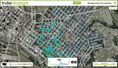
a map of when houses were built
05/30/2007 7:03 AM by John M
Trulia Hindsight is an animated map of homes in the United States. The animations use the year the properties were built to show the growth of streets, neighborhoods and cities over time. View the map.
There is a mysterious *explosion* of new houses at 1900…


Thanks for the link! I wonder if the explosion of new houses doesn’t represent new buildings, but rather the first time things were assessed. I will try and find out for you.
Wasn’t there some sort of issue with lost records from that time period, and lots of property being given “guesstimate” dates around 1900? I know the house I lived in has a 1910 date on assessment records, but maps show it as being present as early as 1890.