RECENT COMMENTS
Eric S. Huffstutler on What is up with the Church Hill Post Office?
Eric S. Huffstutler on What is up with the Church Hill Post Office?
Yvette Cannon on What is up with the Church Hill Post Office?
crd on Power Outage on the Hill
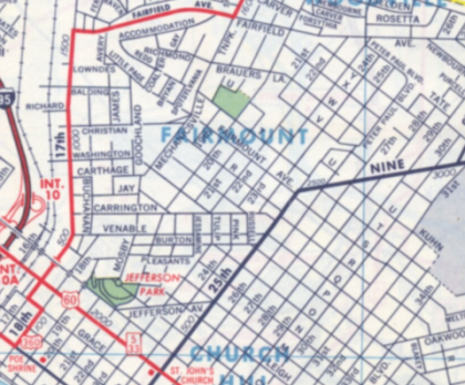
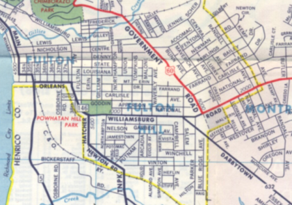
East End 1962
11/27/2009 5:40 PM by John M
Detail from a 1962 map of Richmond published by Esso. Drawn before the construction of I-64, the map also ncludes the pre-MLK Bridge street grid west of Mosby Street and the original streets of Fulton.


I have 1974’s.. I was wondering if you got those from me! It’s not much different.
where oh where are you finding these things? and can you find something about the burying of Richmond’s creeks?
I picked this up at Cold Harbor Antiques in Mechanicsville. The best find that I’ve come across that way was an issue of the East End Press from 1928.
I haven’t run across much on the creeks.
I’m surprised 64 was put in with minimum disruption to neighborhoods.
Minimum disruption? E Washington, Goochland, and other streets on that western partition are completely gone! E Washington hit Mosby at either present-day Mosby Court or at Mosby Middle. My gg grandfather owned a string of homes on E Washington in the 1900 block (1909 and 1911 were two of them; he lived in 1909 E Washington) and I am trying to find any photos, aerial or street level, that show E Washington Street. Any leads?