
RECENT COMMENTS
Joel Cabot on Power Outage on the Hill
Eric S. Huffstutler on What is up with the Church Hill Post Office?
Eric S. Huffstutler on What is up with the Church Hill Post Office?
Yvette Cannon on What is up with the Church Hill Post Office?
crd on Power Outage on the Hill

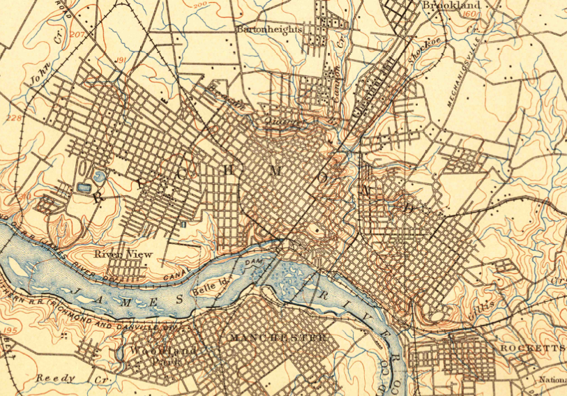
USGS topographic maps of Richmond
04/20/2012 6:32 PM by John M
For more than 125 years, the U.S. Geological Survey (USGS) topographic maps have accurately portrayed the complex geography of the Nation. The USGS is the largest producer of printed topographic maps, and, prior to 2009, USGS topographic maps were created using traditional cartographic methods and printed using the lithographic printing process. Many of these maps are now available online. Searching for Richmond pulls up 26 maps dating back to 1894.

TAGGED: map
These maps helped me find the railroad beds to complete my coal line and RRRR maps. I wish every map ever made of Richmond was put online. I’m still waiting for newer Sanborn ones.