
RECENT COMMENTS
JessOfRVA on then it happens to you...
Becky Metzler on Updated! Guess what's happening on Mosby/Venable?
Mary on then it happens to you...
Sid on then it happens to you...
Becky Metzler on Church Hill Startup Tackles Insurance for Freelancers
Neighbor on then it happens to you...
Dan Rooney on then it happens to you...

Richmond (undated)
05/23/2014 7:15 AM by John M
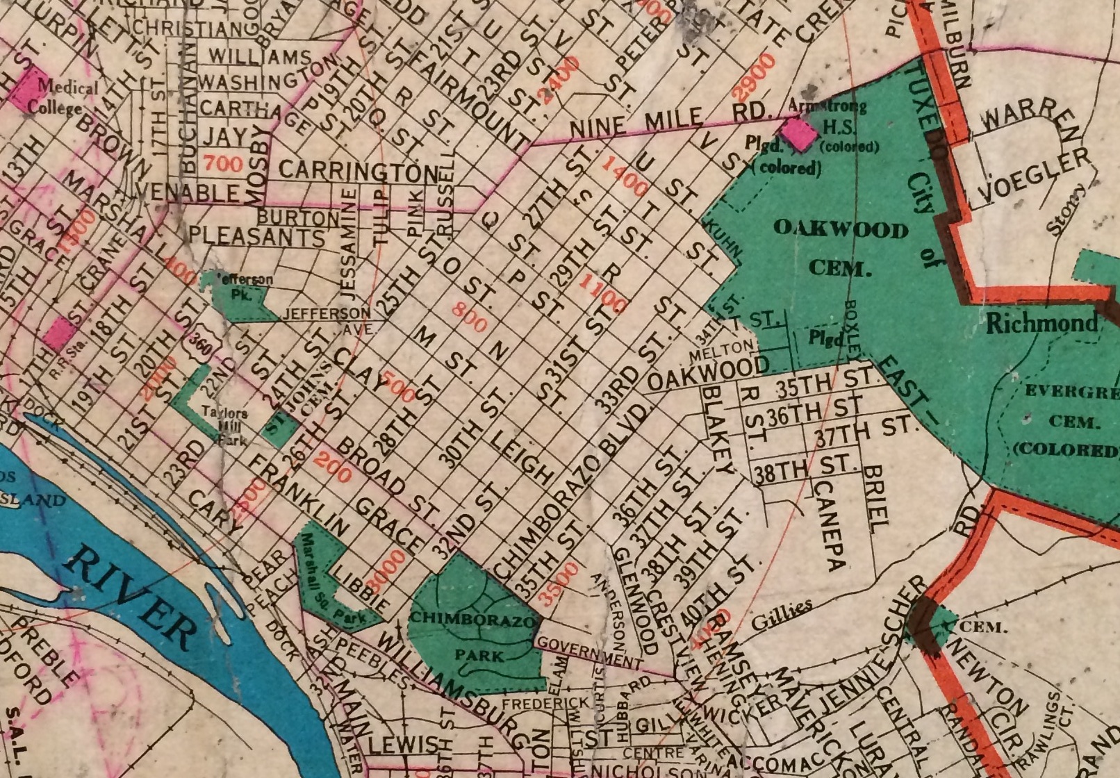
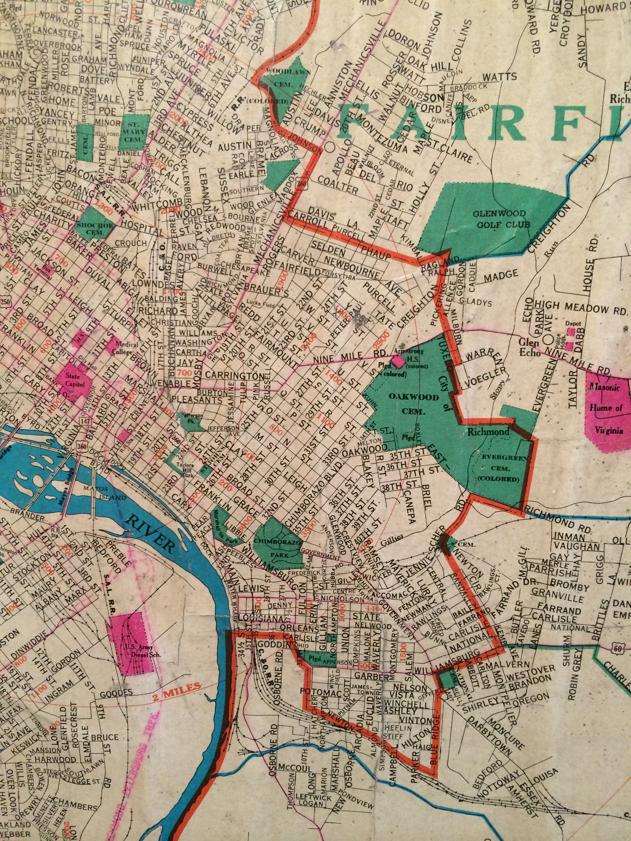
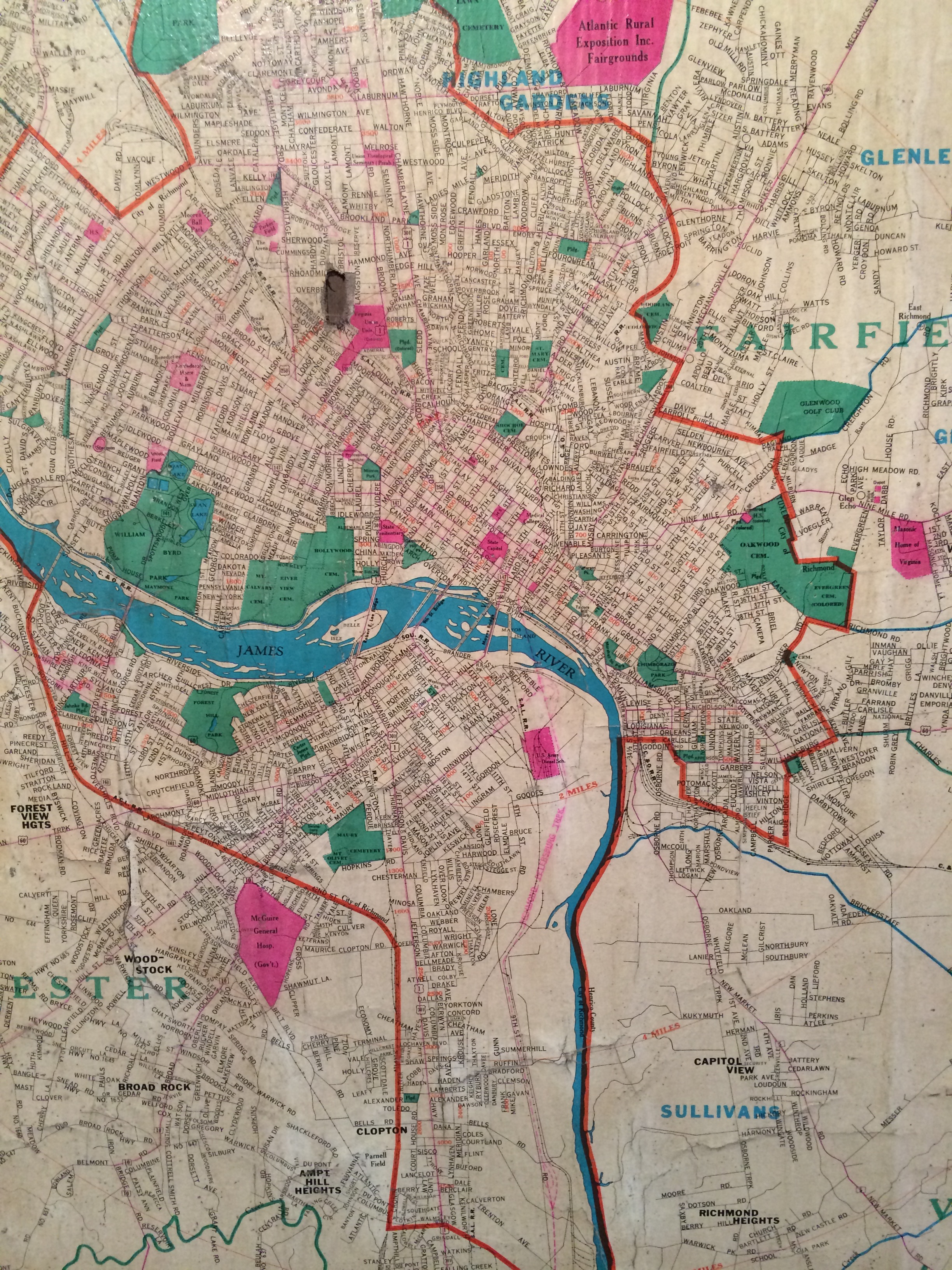
Details from an undated wall map of Richmond at Carytown Bicycle.
I’m guessing that the map is from the early 1950s at the latest… This is the street grid before the construction of 64/95, before Fulton was torn down, before Mosby/Creighton/Fairfield/Whitcomb were built, and the Marshall Street Viaduct was still in place.
Anybody have any suggestions on dating this?
TAGGED: map
Based on notes on the Virginia Highways Project website (http://www.vahighways.com), this map is likely from between 1934 and 1949. Chamberlayne Avenue doesn’t connect to Belvidere Street yet and US 1 and 301 are routed on Broad and Lombardy, Route 147 isn’t on Main yet, and US 360 doesn’t use 17th and 18th yet.
The latest date seems to be 1956. I’ve looked at some of the subdivision plats on Henrico’s site and the latest one I saw was Mayfair Place from 1956 and it’s on the map. It also has the route of the Richmond-Petersburg Turnpike as proposed. It is possible it could be from 1957 while the road was under construction. But I like seeing Richmond’s streets as originally planned before we decided to destroy sections of the city. Also during this time, most of the neighborhoods went by their original names.
Also the congregation at Cedar Street Baptist had not yet petitioned to have the name of Pleasants Street changed to Cedar.
Here is a clue: Armstrong High School appears at the 31st location – the school moved there in 1951. It is also marked as a “colored” school.
Kennedy High School does not appear on the map – this is the location of the current Armstrong, having moved in 2004. Kennedy was constructed in 1968.
Also, the Richmond-Petersburg Turnpike opened in 1958. So the date range for the map would be between 1951 an 1958.
So, this date range for this map
tiny
GOOD WORK!