
RECENT COMMENTS

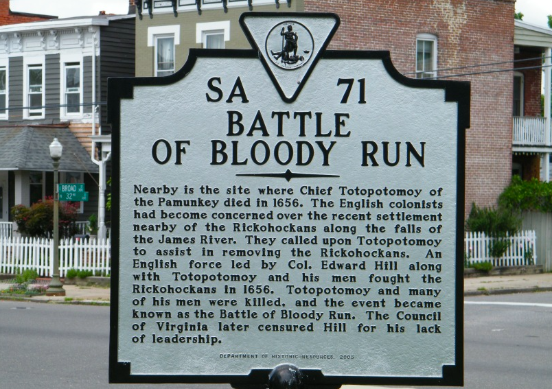
The Battle of Bloody Run
Over three hundred and fifty years ago, the area now occupied by the 200 and 300 blocks of North 30th Street was the site of a mostly-forgotten colonial battle called the Battle of Bloody Run.
Around 1654, a tribe of Native Americans called Rickohockans, who originated south of Lake Erie, were overcome by the powerful Iroquois Nation. By 1656, they moved out of their native region into Virginia, and, according to the Acts of the Assembly, “lately sett downe neer the falls of James river.”
The Assembly passed an act enabling Colonel Edward Hill of Shirley Plantation to recruit 100 men and required local allied tribes to assist Hill in removing the Rickohockans, stating “they shall first endeavour to remoove the said new come Indians without makeing warr if it may be, only in a case of their own defence.”
Hill clearly disregarded this instruction. The ensuing battle was so intense that according to legend, a natural spring in the area was dyed red from the blood of the dead and wounded, earning the name Bloody Run.
In addition, Hill prematurely withdrew his colonial troops, abandoning the one hundred allied Pamunkey fighters who had joined him. Most were killed, including their chief, Totopotomoi. Totopotomoi’s wife Cockacoeske took over his position as leader within the Pamunkey tribe. Exactly twenty years after the battle, in 1676, the Assembly asked her to provide men to help them quell Bacon’s Rebellion. She “upbraided” them for their treatment of Totopotomoi, and offered twelve men, although she had at least 120 available.
Hill was reprimanded by the Assembly, and “without any contradiction hath been found guilty of those crimes and weaknesses there alleaged against him and for the vindicating themselves from any imputation of his crimes and deficiencies have ordered that his present suspension from all offices military and civil that he hath had or may have continue…”
As Richmond developed over the following centuries, Bloody Run Creek was a well-known area in the city, used both as a de facto eastern border to Richmond, and also as a landmark.
The spring for the creek was located on the southwest corner of East Marshall and North 31st streets, and the creek flowed down the eastern side of 31st Street, across what is now Broad Street, down Chimborazo Hill, and into Gillies Creek in the Rocketts area.
The spring is located on numerous early maps, including the Charles S. Morgan 1848 map of Richmond (which also denotes the battlefield alongside the spring), and the 1856 map by William Sides and Moses Ellyson (below).
— ∮∮∮ —
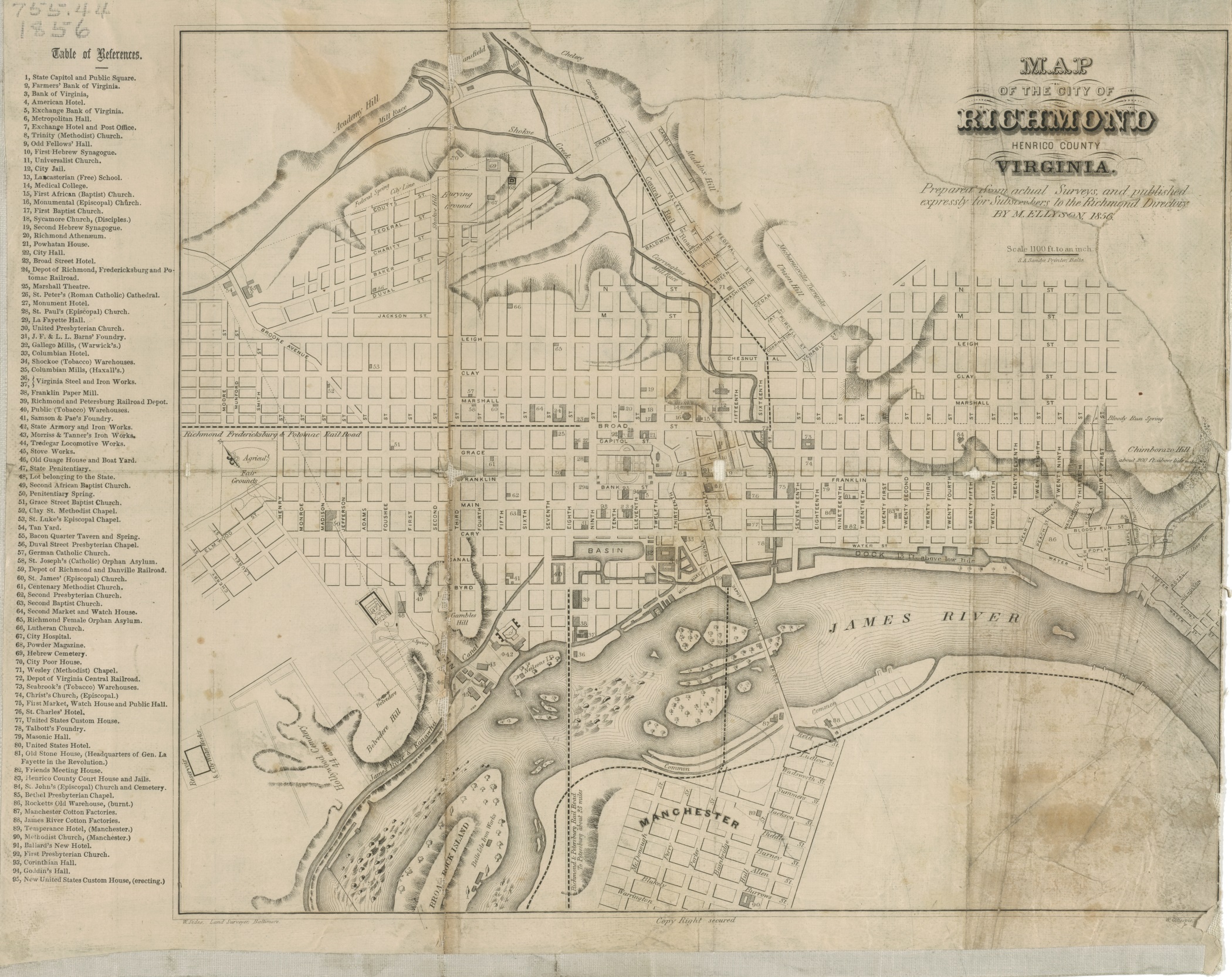
Click to view entire map
— ∮∮∮ —
The eastern edge of the 1867 annexation of the Chimborazo area into the city follows the line of the creek almost exactly. Several Mutual Assurance Fire Insurance policies from the early decades of the nineteenth century, as far back as 1808, list residences in this area as “near Bloody Run Spring.”
Chimborazo Hospital used the creek to supply water to its bathhouse, and it is very likely that people in the area used it for drinking water, as the spring was tested and declared safe in 1876.
In an interview conducted during the Works Progress Administration, a former resident of Church Hill named Mrs. J.G. Crouch remembered that Bloody Run Creek had been used for baptisms by African American churches. She speculated that the spring had dried up sometime in the late 19th century. In fact, the city purposely buried the spring and creek in 1884. Today, nothing of the spring or creek is visible. Two historic markers, however, commemorate the battle.
— ∮∮∮ —
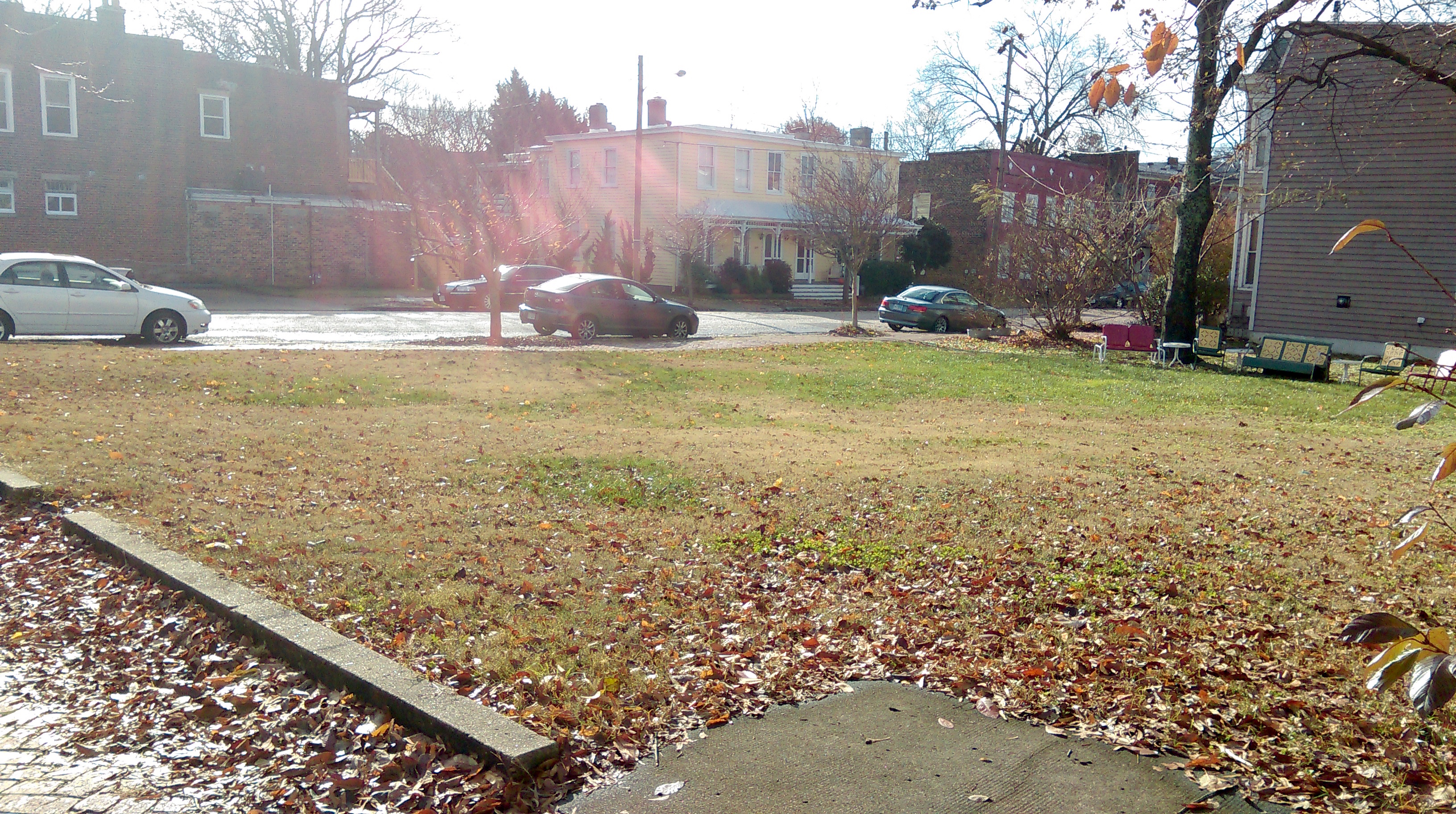
31st and Marshall Street (2014)
Sorry, I meant to write that the creek went down the western side of 31st Street, not the eastern side.
Excellent article Tricia!
Man I love these articles, Tricia, thanks. I believe there are a lot of springs on the Hill or the water from the Bloody Run spring has rerouted. Broad and 33rd seems to have one and 30th and Broad has a lot of water just below the surface. Does anyone know more about the springs of Church Hill?
There were a lot of springs all over Richmond. There was one near 25th and Franklin in Church Hill, plus springs near Hollywood Cemetery, Shockoe Cemetery, Capitol Square, 7th and Leigh, Scott’s Addition, Spring Street, and one near where the Main Street Station is now. I’m sure there were a lot more, though. There seem to have been a lot of little creeks that ran into Gillies Creek that have been buried or rerouted.
Young’s Spring, just across the street from Bryan Park, is where Gabriel planned his rebellion in 1800.
Tricia you should write a book. I really enjoy your writing!