
RECENT COMMENTS
Eric S. Huffstutler on What is up with the Church Hill Post Office?
Eric S. Huffstutler on What is up with the Church Hill Post Office?
Yvette Cannon on What is up with the Church Hill Post Office?
crd on Power Outage on the Hill

New map site lets you dig into land use, age of buildings, employment, population and more
12/23/2015 9:29 AM by John M
A new site developed by the Center for Urban and Regional Analysis at VCU lets you pull up info “about land use, development density, assessed value, age of buildings, employment, population, public facilities, environment and government plans.” CURA MetroView “offers both a holistic and a highly detailed perspective of the region, whether it’s a stand-alone building, a neighborhood or a suburban area that crosses multiple localities.”
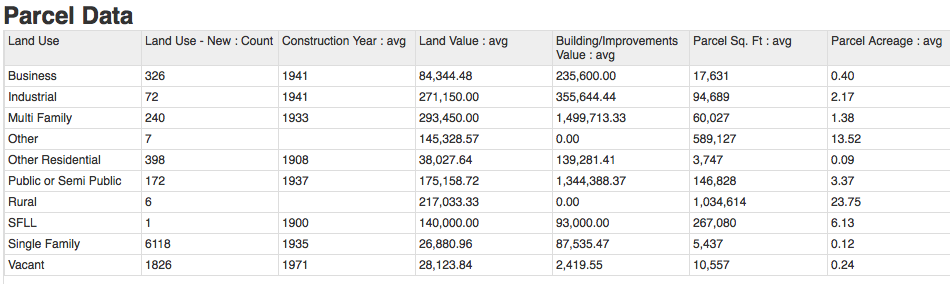
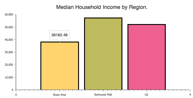
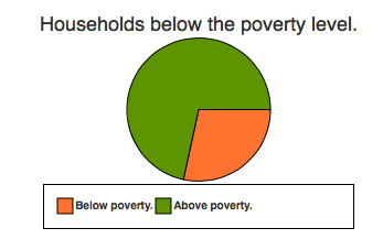
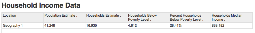
You can view data profile for any area by outlining it on a map. I’ve included some of the data below from a map of what is essentially the CHPN coverage area.
— ∮∮∮ —
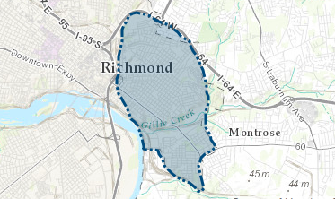
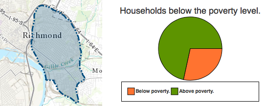
General CHPN coverage area
— ∮∮∮ —
— ∮∮∮ —
— ∮∮∮ —
— ∮∮∮ —
Great resource. Thanks for sharing!