
RECENT COMMENTS
Joel Cabot on Power Outage on the Hill
Eric S. Huffstutler on What is up with the Church Hill Post Office?
Eric S. Huffstutler on What is up with the Church Hill Post Office?
Yvette Cannon on What is up with the Church Hill Post Office?
crd on Power Outage on the Hill

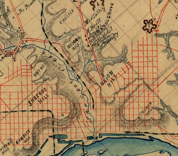
From a map of Henrico County (1864)
11/25/2011 3:27 PM by John M

CREATED/PUBLISHED
[1864]NOTES
Reference: LC Land ownership maps, 1281Shows the names of some residents.
Relief shown by hachures.
Title and date from Stephenson’s Civil War maps, 1989.
Drawn on a 3/8-inch pencil grid.
Pen-and-ink, pencil, and watercolor on paper composed of many sheets pasted together. Sectioned in 3 and mounted on cloth.
TAGGED: map
I used this map to help with my old roads map. It amazes me how so any maps from the same year or period have different roads.