
RECENT COMMENTS

New map lets you explore historic Richmond
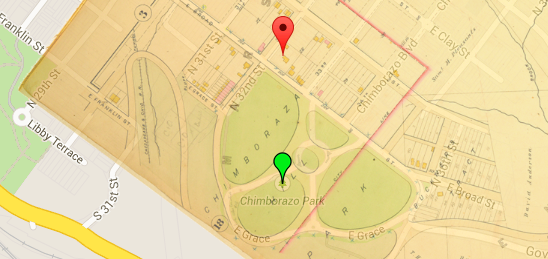
VCU Libraries has just launched an interactive version of a Richmond map atlas from 1889 which gives you to look at Richmond then and now, featuring photos and illustrations from different eras.
Check it out the interactive Baist Atlas.
— ∮∮∮ —
From the site
— ∮∮∮ —
From a VCU News story about the site:
The interactive Baist Atlas site features an in-depth contextual exploration of each area of the city, information on various points of interest located within each panel, a number of historical illustrations and photographs from other VCU digital collections, and a street index.
The entirety of the map is juxtaposed over the modern Richmond map in Google Maps, showing both how the Richmond area was outlined by Baist and how Richmond has changed, grown and evolved. Geospatial data used to create the modern day map overlay is also available for download and use.
“We’ve created a whole new way for people to interact with the map,” Work said. “It’s also fully downloadable so people can use it on their own. We also see this as a nice segue into other VCU Library special collections – because you can click through and keep exploring other VCU digital collections.”
So, is this one of the few maps that shows the Church Hill Tunnel back when the tunnel was still being used? Pretty cool.