RECENT COMMENTS
Eric S. Huffstutler on What is up with the Church Hill Post Office?
Eric S. Huffstutler on What is up with the Church Hill Post Office?
Yvette Cannon on What is up with the Church Hill Post Office?
crd on Power Outage on the Hill

The highest spot in Church Hill
04/26/2015 8:00 AM by John M
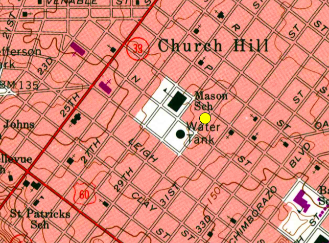
If I’m reading this topographical map of Richmond (PDF) correctly, technically the highest spot in Church Hill is over by the water tower, crossing the 170 line. I think that the yards on 600 block of 28th might be higher, though, sitting up off the street like they do.
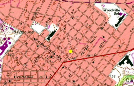
It appears that the highest spot in the area, though, is over by 25th and County Road where Fairmount and Woodville meet, crossing the 180 line.
— ∮∮∮ —


Very cool, John. Thanks
During Gaston the water poured down 28th street like a river, ending up in Shockoe Bottom 4+ feet on 17th Street by rush hour.
Is there a better map? The grades are so far apart and know there must be peaks that most likely raise above the 180-foot marks not shown on this map?
Something of interest is that there was a hill that ran across Broad Street at one time and basically ended where Hill Café is. There were streets that routed around it to get to the other side before it was cut down.
The City of Seven Hills: How high is Richmond?
http://wtvr.com/2017/03/03/the-city-of-seven-hills-how-high-is-richmond993368/