
RECENT COMMENTS

Poverty increasing regionally, on decline in sections of the East End
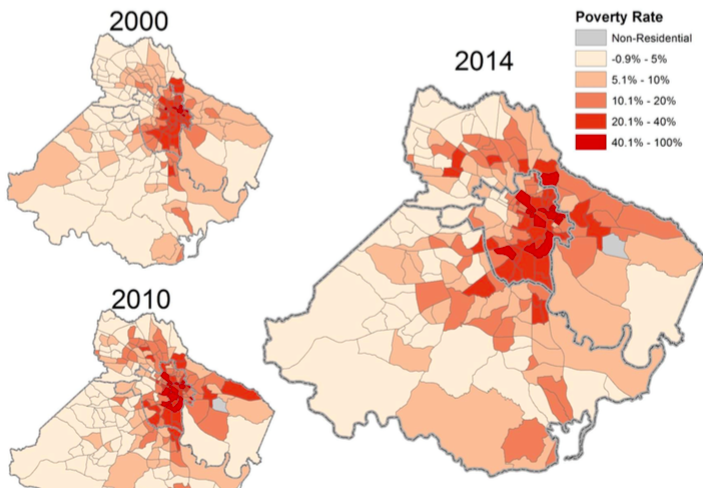
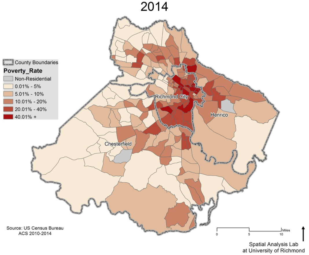
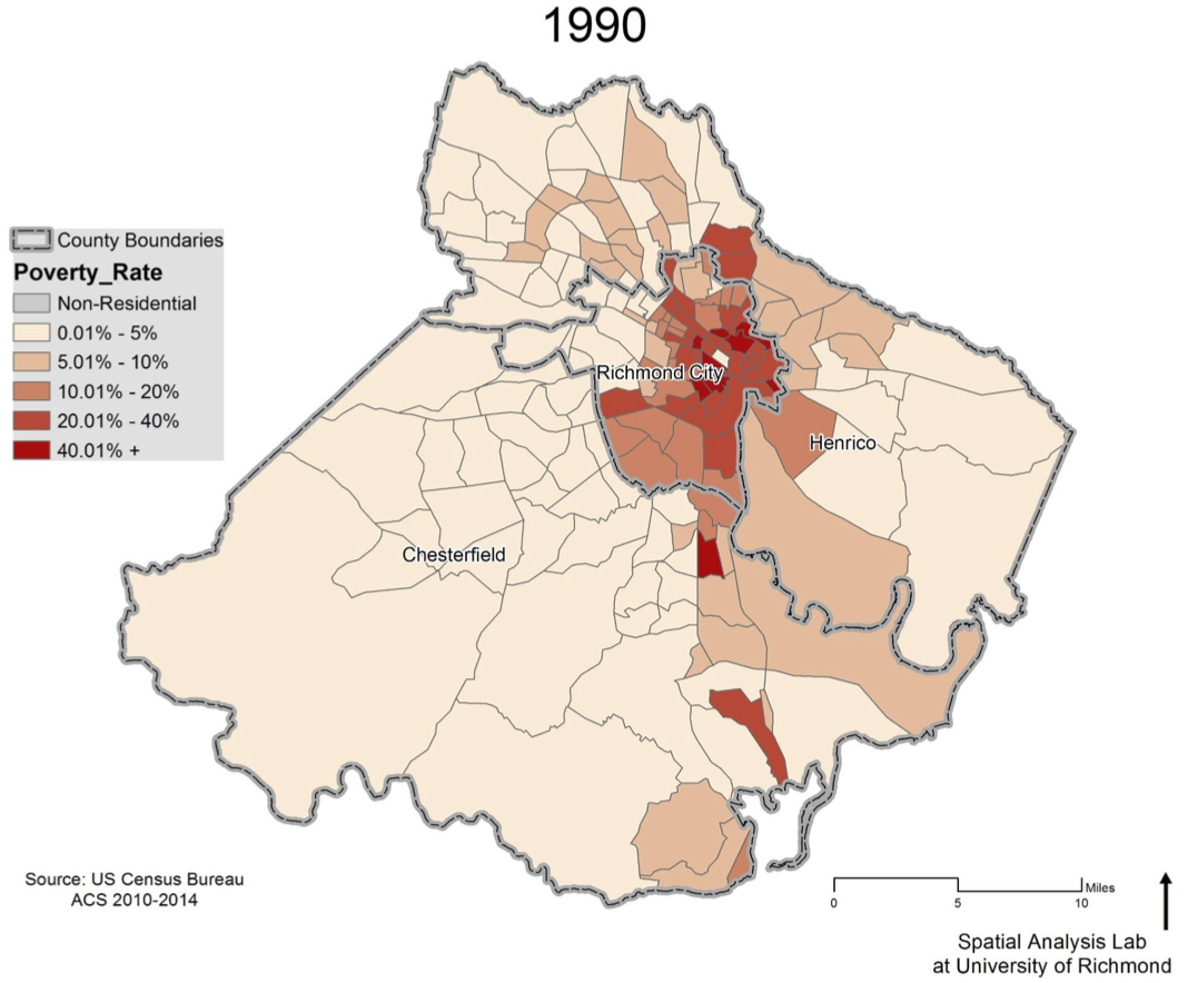
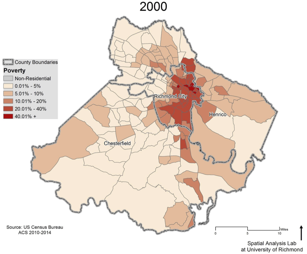
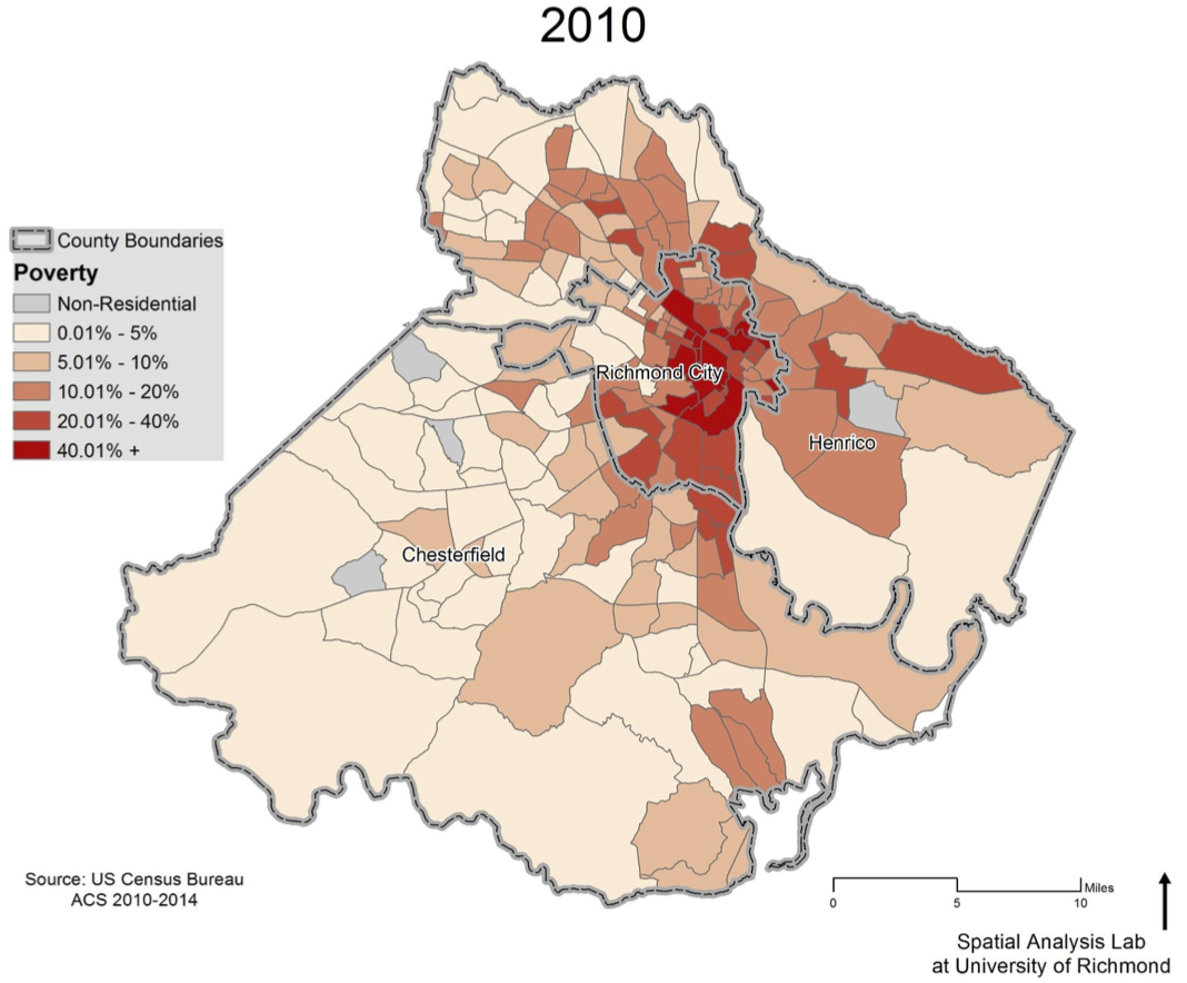
The main deliverable of John Moeser’s presentation (PDF) at the Unpacking the Census: 5 years later is that the poverty level in the city is stubbornly holding steady, and rising in the surrounding counties. The poverty rate in the city is just over 25%, and just under 12% for the region.
From Tina Griego’s Beyond Bureaucracy at Richmond Magazine yesterday:
One in four Richmonders, about one in 10 Henricoans, and roughly one in 14 Chesterfield County residents, live in poverty. (The poverty level used by the U.S. Census for a family of four is $24,230 – or $12,316 for an individual under 65.) Poverty in Henrico increased the most from 2010 to 2014. Raise the income threshold to $45,000, where a family is getting by but at risk of falling into poverty should it be struck by divorce or a lost job or a major health crisis, and the situation is more dire. Roughly one-third of the families in Chesterfield and Henrico, and one half of the families in Richmond, walk the edge of just-making-it.
On a very local level, census tracts 209 and 208 (roughly Oakwood and Chimborazo) fell below the 20% poverty rate threshold by 2010, and tract 206 (parts of Church Hill, Church Hill North, Union Hill) fell below the 10% poverty rate by 2014 – some of the very few areas in the region to have experienced a drop in the rate over the past few decades. Without knowing the underlying population numbers, it is unclear if this is due to a drop in the number of individuals living below the poverty line, an increase in those above, or both.
By contrast, the census tract which includes Fairfield Court and Creighton Court has the highest percentage of residents in Richmond living in poverty at 69.6% (as of 2014). This is 3rd highest in the state after tract 11400 in Hampton (76.7%) and tract 4200 in Portsmouth (70.5%). Gilpin Court, Mosby Court, and Whitcomb Court are all close behind at 66.7%, 67.2%, and 66%.
Take the time to dig into Moeser’s presentation (PDF), it is a fascinating and compelling look at the shifting geography of poverty in the Richmond region.
— ∮∮∮ —
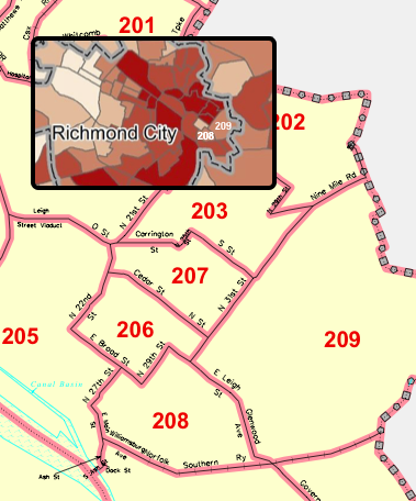
Census tracts 206, 208, and 209
— ∮∮∮ —
Wasn’t there an post a while ago about Oakwood-Chimborazo having about a 25 percent population increase since the last census? Considering A) the number of evictions (as evidenced by obvious tenant turnover / piles of furniture on the curb – just check seeclickfix if anyone doubts me.) and B) the number of homes being built or renovated (especially formerly vacant homes) in the area, it seems reasonable to conclude that long term residents are not being lifted out of poverty. Instead, it looks like poverty is being diluted and displaced to the counties or other parts of the city.
East End population rising for first time since at least 1990
/2015/12/03/census-bureau-estimates-richmond-east-end-populations-rising_47332/
Rents (2000-2010)
/2015/11/11/rents-2000-2010_46801/
Looking at the areas of western Henrico, it looks like some of the areas with high concentrations are where there are large concentrations of assisted living facilities. It would be interesting to see this data with those over 65 filtered out. In other words look for the working age poor.
Also, does this account for college students. Some of the areas around the universities could be artificially high if that has not been filtered out.
Well these figures will most likely change when the new population of Lambert Landing is factored in.